TIMELINE: Snow reaching Bay Area's highest peaks with up to 8 in. coming to Mt. Hamilton


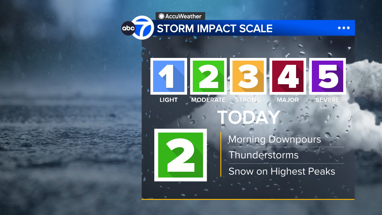
SAN FRANCISCO (KGO) -- Bay Area storms continue with a Level 2 on the ABC7 Exclusive Storm Impact Scale Tuesday.
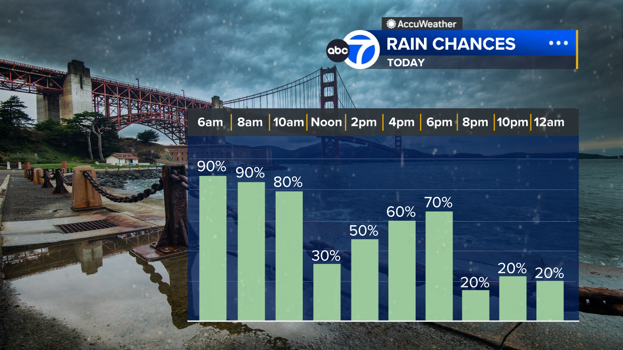
The heaviest rain will fall Tuesday morning until 11 a.m. with the chance of thunderstorms.
LIVE: Track rain in San Francisco Bay Area with Live Doppler 7
STORM TIMELINE UPDATES
Downpours become widely scattered after 11 a.m. but continue throughout the evening.
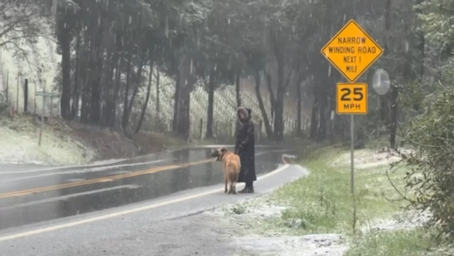
Snow is also reaching the Bay Area's highest peaks. In the North Bay, snow has been falling Tuesday morning on Mount Saint Helena. Snow was also seen falling in Cobb in Lake County.
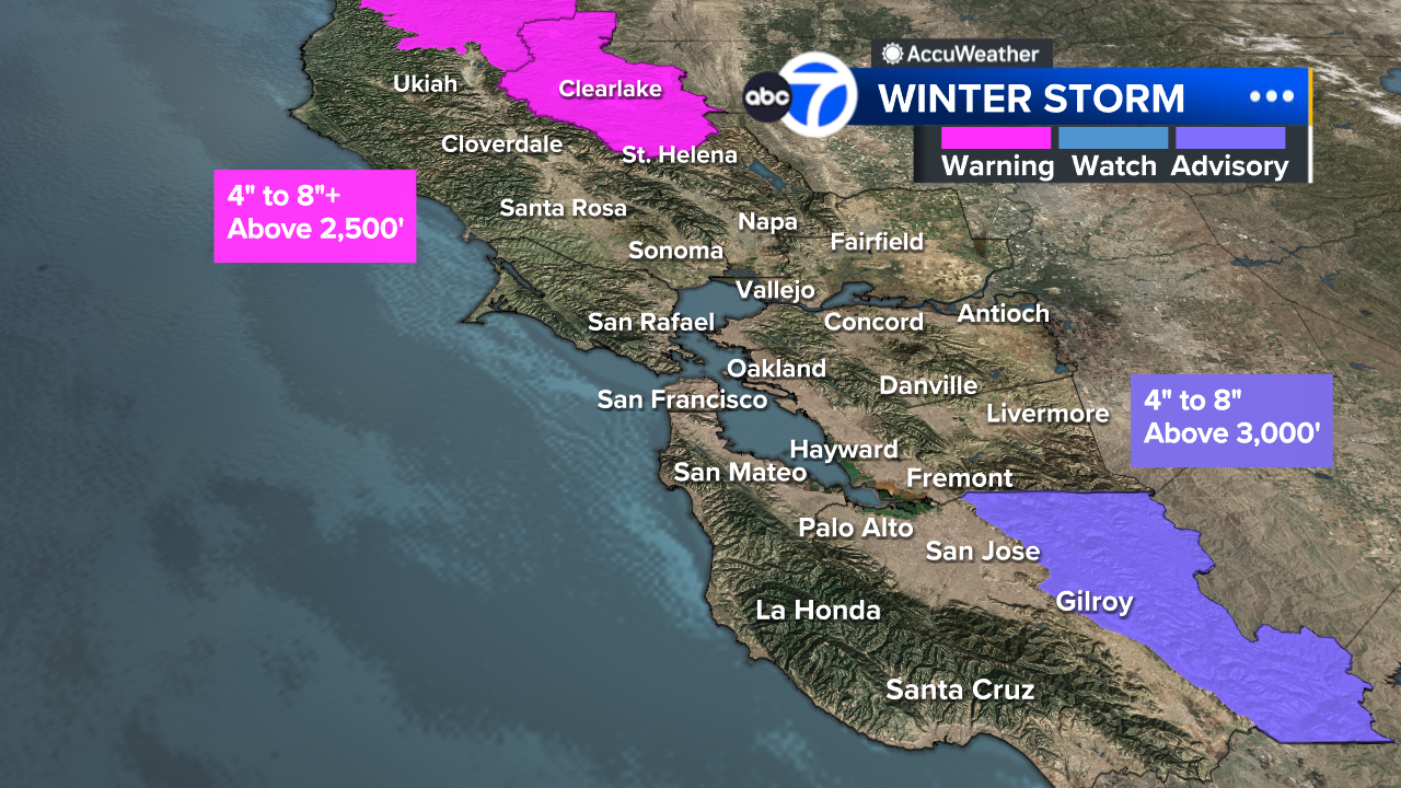
In the South Bay, A Winter Weather Advisory is in effect for the eastern hills of Santa Clara County. That's where Mount Hamilton could receive 4-8 inches of snow tomorrow Tuesday afternoon through Wednesday morning. You can watch a webcam here. Meteorologist Drew Tuma says that as of 8 a.m. Tuesday there was already 3 inches of snow on the ground with more falling.
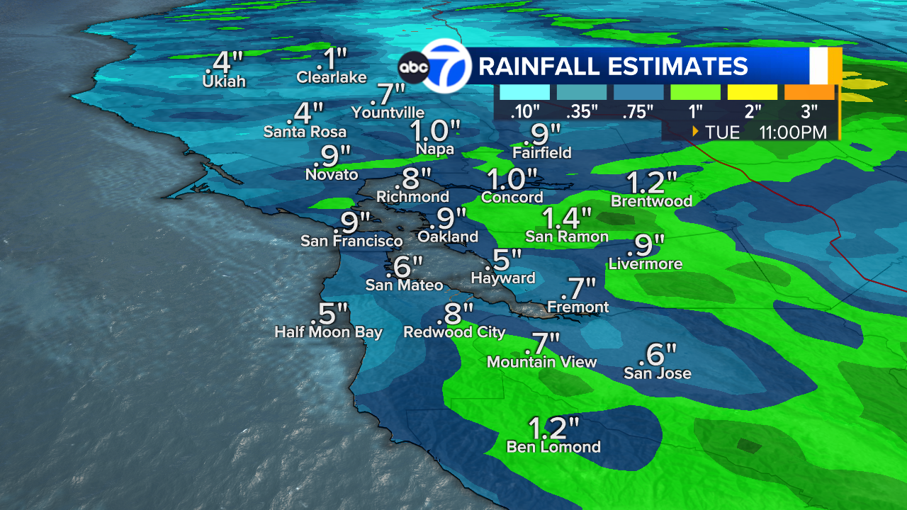
Rainfall totals for most of the Bay Area will be .50" to 1" on Tuesday.
A Winter Storm Warning continues for the Sierra until Wednesday night with feet of snow falling.