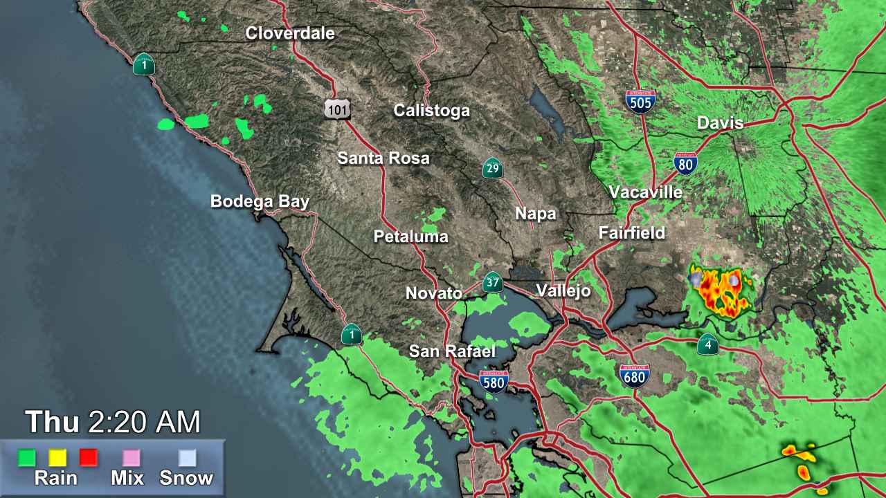
North Bay

- Severe Thunderstorm Warning
SVRSTO The National Weather Service in Sacramento has issued a * Severe Thunderstorm Warning for... South central Plumas County in northern California... Eastern Butte County in northern California... Northeastern Yuba County in central California... Western Sierra County in northern California... North central Nevada County in northern California... * Until 830 AM PDT. * At 749 AM PDT, a severe thunderstorm was located near Alleghany, or 9 miles southwest of Downieville, moving north at 25 mph. HAZARD...Quarter size hail. SOURCE...Radar indicated. IMPACT...Damage to vehicles is expected. * Locations impacted include... Downieville, Alleghany, American House, La Porte, Pike, Little Grass Valley, Camptonville, and Gibsonville.More
- Winter Storm Warning
* WHAT...Heavy snow. Total snow accumulations 1 to 2 feet above 4500 feet, with up to 3 to 4 feet at the highest peaks. Minor snowfall accumulations of 2 to 4 inches down to 4000 feet. Winds could gust as high as 50 mph. * WHERE...West Slope Northern Sierra Nevada and Western Plumas County/Lassen Park above 4500 feet. * WHEN...From 5 PM Friday to 11 PM PDT Sunday. * IMPACTS...Travel could be very difficult to impossible. The hazardous conditions could impact the Friday evening commute and weekend mountain travel. * ADDITIONAL DETAILS...Snow levels generally remain above pass levels through Friday afternoon, dropping to around 6000-7000 ft Friday night-Saturday, then lowering to around 4000-5000 ft late Saturday into Sunday. Heaviest snow rates and lowest snow levels will be Saturday afternoon through Sunday.More
- Winter Storm Watch
* WHAT...Heavy snow. Snow accumulations between 6 to 10 inches for communities surrounding Lake Tahoe and up to 7000 feet, and 12 to 28 inches above 7000 feet and for Sierra passes. Winds gusting as high as 90 mph along the Sierra crest and 20-35 mph for communities surrounding Lake Tahoe Saturday afternoon. * WHERE...Greater Lake Tahoe Area. * WHEN...From Saturday morning through Sunday evening. * IMPACTS...Travel could be very difficult to impossible, especially for the Saturday evening and Sunday morning commutes. Strong winds could cause damage to trees and power lines.More