Bay Area storm timeline: Last day of heavy showers, chance of thunder before rain eases up

Friday, January 29, 2021

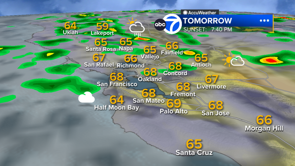
SAN FRANCISCO (KGO) -- Waves of showers and downpours continue Thursday with the South Bay receives the greatest amounts, according to ABC7 News meteorologist Mike Nicco.
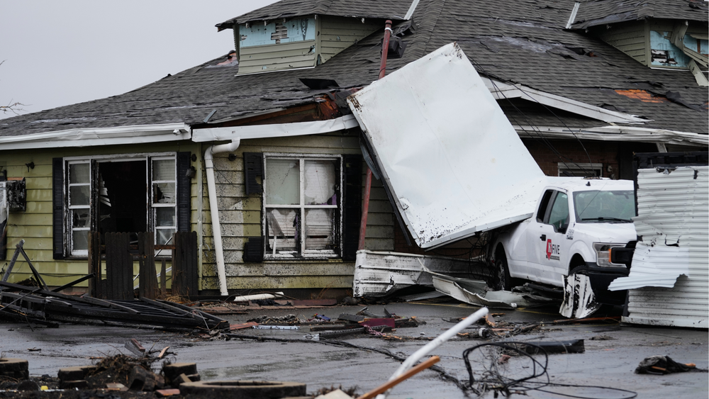
The storm, which started as a level 3 on our Storm Impact Scale, has been hitting the Bay Area since 4 p.m. Tuesday. The storm has now been downgraded to a level 2.
WATCH: Tracking the Storm: California Team Coverage

Here's how long you can expect the torrential rain to last amount, as well as details on the winds and how much snow we expect in the Sierra.
RAINFALL TIMING/ESTIMATES:


- Showers will continue Thursday.
- They will be moderate to heavy in pockets.
- There is still a chance of thunder.
- The Atmospheric River is still stalled over the Central Coast where flooding problems continue.
- A Flash Flood Watch is in effect until 4 p.m. Thursday for the burn scar areas where flash flooding is likely and there is a possibility of mudslides.
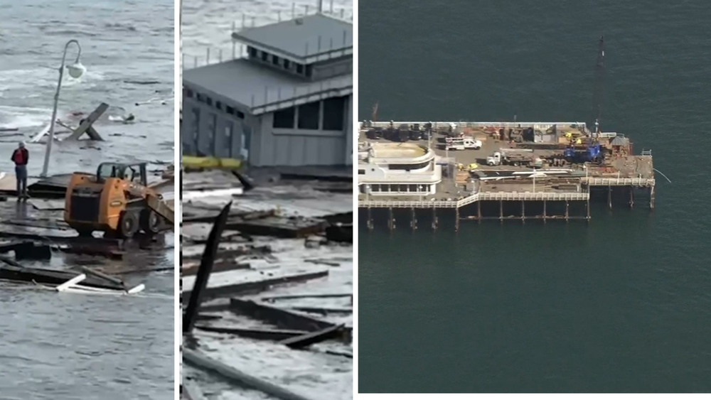
EVACUATIONS: Evacuations ordered in Santa Cruz, San Mateo counties ahead of storm, possible mudslides

KGO-TV
Copyright © 2026 KGO-TV. All Rights Reserved.