Live storm updates: Bay Area cleans up after severe flooding with more storms, king tides coming

ABC7 Bay Area Digital Staff Image
Last updated: Sunday, November 22, 2026 10:27PM GMT
ABC7 Bay Area 24/7 live stream
Stream local breaking news and original programming, live 24/7, from ABC7 Bay Area.

Record-breaking rainfall left much of San Francisco underwater on Wednesday as a Level 3 storm dumped several inches of rain across the region.

Videos sent to ABC7 Eyewitness News showed residents wading through knee-deep water and cars trying to navigate flooded roadways.

LIVE: Track rain in San Francisco Bay Area with Live Doppler 7

Downtown San Francisco also saw a record amount of rainfall. The 2.31 inches of rain recorded was the highest for Nov. 18, breaking a record set in 1918. The average rainfall in San Francisco for the whole month of November is 2.6 inches, according to the weather service.

As the Bay Area cleans up and recovers from the storm impacts, the region is preparing for the next round of storms that will coincide with the king tides, which will begin Sunday and bring more flooding.

We want to hear from you! Submit your weather photos here.

Get the latest Bay Area AccuWeather forecast here.

Get live traffic updates here.


J.R. Stone Image
Nov 20, 2026, 8:14 PM GMT

SF mayor defends storm preparations after city inundated with severe flooding
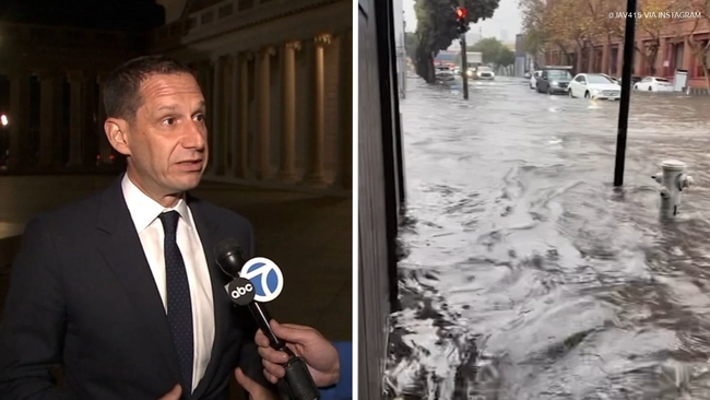
San Francisco officials are defending their preparation for Wednesday's storm after widespread flooding overwhelmed parts of the stormwater system.

San Francisco officials are defending the city's preparation for Wednesday's storm after widespread flooding inundated streets and overwhelmed parts of the stormwater system.

The flooding prompted questions about whether the city had done enough to prepare after days of advance warning about the storm. During an interview Thursday night, ABC7's J.R. Stone asked San Francisco Mayor Daniel Lurie whether the city had fallen short.

"Listen, we are out front every single day. We are out there tonight; we were out there last night," Lurie said. "There was no more flooding last night which was a good sign. We're going to do everything that is humanly possible to protect the residents of our city, small business owners of our city."

The mayor defended the city's response to the storm, which caused flooding severe enough that water was reportedly shooting out of storm drains. Lurie said 10 to 15 areas of the city were hit hard.

The day before the storm, Rachel Gordon of San Francisco Public Works said crews had addressed dozens of storm drain issues.

"We had about, in the last couple of days with the storms, about 80 storm drains we cleared," Gordon said.

ABC7 Eyewitness News later asked the mayor whether more drains could have been cleared before the storm.

"The storm drains in the flood-prone areas were clear at 9:55 am. There was no flooding and then at 9:58 it came up in neighborhoods across this city in a way we have not seen before," Lurie said.

On Thursday night, Gordon clarified by phone that the 80 storm drains referenced were service calls crews responded to. She said Public Works and San Francisco Public Utilities Commission crews had already been proactively clearing storm drains and cleared thousands during the storm.

According to the San Francisco Public Utilities Commission, the city's 22 miles of underground stormwater storage reached capacity during the storm.

"Can hold over 200 million gallons of water at a time, but when you get two inches of rain in three hours it can overwhelm the system. It was a once in a 50, 100-year storm is what we were told by the National Weather Service," Lurie said.

The mayor said the city's focus has shifted to preparing for the next storm system and king tides expected Tuesday. He said San Francisco has 50,000 sandbags available to distribute and has extended hours at the Public Works operations yard.

In a statement, the San Francisco Public Utilities Commission said the city was struck by a historic storm that brought an average of 3 inches of rain, with roughly half of that falling within a three-hour period.

Tiffany Liou Image
Nov 20, 2026, 3:35 PM GMT

Bay Bridge toll plaza carpool lanes closing for flood work

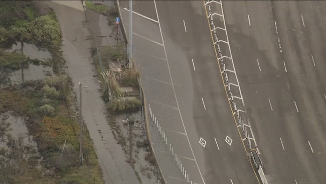
Drivers crossing the Bay Bridge this weekend should expect changes at the toll plaza as Caltrans crews work to reduce the risk of flooding ahead of an anticipated storm next week.

Drivers crossing the Bay Bridge this weekend should expect changes at the toll plaza as Caltrans crews work to reduce the risk of flooding ahead of an anticipated storm next week.

The two right-hand carpool lanes at the Bay Bridge toll plaza are scheduled to close at 8 a.m. Friday and remain closed until 8 a.m. Monday. The closure is partial, and drivers are being advised to use the remaining lanes to the left during the weekend.

According to Caltrans, crews will install a tiger dam, a 600-foot-long barrier designed to help limit flooding on the bridge approach. The work is being completed during a break in storm activity.

The flooding prevention effort comes after previous flooding incidents in the area and as Thanksgiving travel begins to increase Friday. Caltrans spokesperson Pedro Quintana said the project is necessary for safety reasons.

"It's about a half-mile stretch that we are doing to make sure we are protecting this critical infrastructure, the toll plaza, with these next storms and the king tide," Quintana said. "We want to make sure this toll plaza stays open, so we are expecting minor delays with this HOV closure, so we are asking folks to use these other open lanes."

Officials said motorists should anticipate minor delays while the two HOV lanes are closed. Drivers commuting across the Bay Bridge this weekend are encouraged to plan ahead and use alternate routes if possible.

The lane closure is scheduled to remain in effect through Monday morning while crews complete the installation.

Bay City News logo
Nov 20, 2026, 3:06 AM GMT

Evacuation warning lifted for residents in Big Sur area, Monterey Co. Sheriff says

An evacuation warning was lifted Thursday afternoon for residents and businesses in the Big Sur area, the Monterey County Sheriff's Office said.

The evacuation warning was issued Wednesday for the area, including within and near the Timber and Plaskett Fire burn areas. It was issued out of risk of flash floods, landslides or debris flows.

At 4 p.m. Thursday, the county lifted the warning.

State Highway 1 remains closed from Palo Colorado Road to Fernwood to the north and Regents Slide, just south of Deetjens Slide, the south.

Caltrans is actively working to clear the mudslide and boulders in the roadway, the agency said.

Heavy rainfall in the burn areas threatened to create landslides that could make roads impassible, the Sheriff's Office said.

The decision to cancel the warning follows continued monitoring of weather conditions and the scheduled expiration of the National Weather Service flash flood watch, the Sheriff's Office said.

According to the NWS, approximately 3 to 6 inches of rain have fallen across the Santa Lucia Range over the past 24 hours, impacting the Timber and Plaskett Fire burn areas.

Additional rainfall remains possible, and areas affected by recent wildfires continue to be vulnerable to flash flooding, mudslides, rockslides, and debris flows.

Luz Pena Image
Nov 20, 2026, 3:53 AM GMT

Residents blame SF Muni buses for worsening flooding during storm

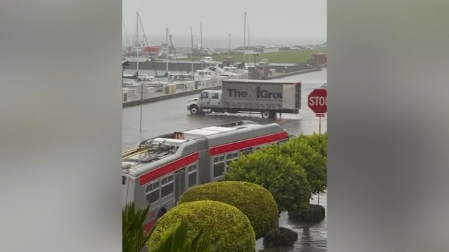
Some San Francisco residents say buses and other vehicles traveling through flooded streets worsened conditions by pushing water into buildings.

Residents in San Francisco's Mission and Marina neighborhoods are urging city officials to make changes before the next major storm after flooding this week damaged homes and properties.

Some residents say buses and other vehicles traveling through flooded streets worsened conditions by pushing water into buildings.

As streets flooded Wednesday morning, residents in both neighborhoods described water entering homes and businesses.

Several residents blamed vehicle traffic, particularly city buses, for creating waves in standing water. Marina resident Bob Priest-Heck said buses traveling along Marina Boulevard contributed to flooding conditions near his property.

"It creates a tidal wave going down Marina Boulevard, which eventually broke through the barrier of the sandbags," Priest-Heck said.

Darlene Hines, a Marina resident, said she witnessed vehicles driving through flooded streets and believes it intensified the flooding.

"The buses and the cars going up and down the streets. Fast, not slow. So, it just rushed in," Hines said.

As flooding affected parts of the city, Mayor Daniel Lurie held an emergency news conference and urged residents to avoid flooded areas.

"Stay away from flooded streets and never walk through or drive through flood water," Lurie said.

Emergency responders sometimes must travel through flooded areas, but San Francisco Fire Department Lt. Bruno Bovo said crews operate under specific safety guidelines during severe winter weather.

"For our severe winter response, the water, the standing water is not to go above one third of the tire. And the speed limit is five miles lower than the given speed limit," Bovo said.

When asked whether those protocols were followed during Wednesday's flooding, Bovo said, "Yes it was."

Residents contend that Muni vehicles did not follow the same approach. The San Francisco Municipal Transportation Agency declined to comment.

In a statement, the city's Department of Emergency Management said in part, "We take seriously the concerns residents in the Mission and the Marina have raised about traffic on flooded streets."

The department did not announce specific changes.

Supervisor Stephen Sherrill, who represents the Marina, said the San Francisco Municipal Transportation Agency has committed to working with public agencies to install water-height monitors in flood-prone areas.

"They're confirming that they will work with public commission to have water height monitors on site. And when the water comes high enough, and they haven't confirmed what that level is, they will reroute the buses," Sherrill said.

For some Marina residents, rerouting buses would address only part of the problem. They are also calling on the city to restore an outfall pipeline that was removed in 2021.

When asked what action she would like the city to take, Hines said, "open up the outfall. It's got to happen. It's the only answer."

Full DEM Statement:
"Yesterday was the wettest November 18 on record in San Francisco. For people whose homes or businesses flooded, the impact lasts well beyond the storm.

"The Department of Emergency Management has coordinated interdepartmental storm preparedness since September with a heightened planning posture headed into the winter, and we activated the City's Emergency Operations Center at 5am to coordinate the response. City crews worked to clear storm drains, responded to downed trees, and distributed sandbags to help people protect their property.

"We take seriously the concerns residents in the Mission and the Marina have raised about traffic on flooded streets. Hearing directly from residents, alongside reports from crews in the field, helps us improve how we manage traffic and warn people when streets become unsafe, particularly given the likelihood of increased storms over the coming months. We encourage everyone to avoid flooded areas and not drive, walk, or cycle through floodwaters.

"More storm safety guidance is available at sf.gov/storms."