Bay Area residents witness rare waterspouts over San Francisco Bay
There are a handful of waterspouts listed in the Bay Area in the last 28 years, but they were only over the ocean.
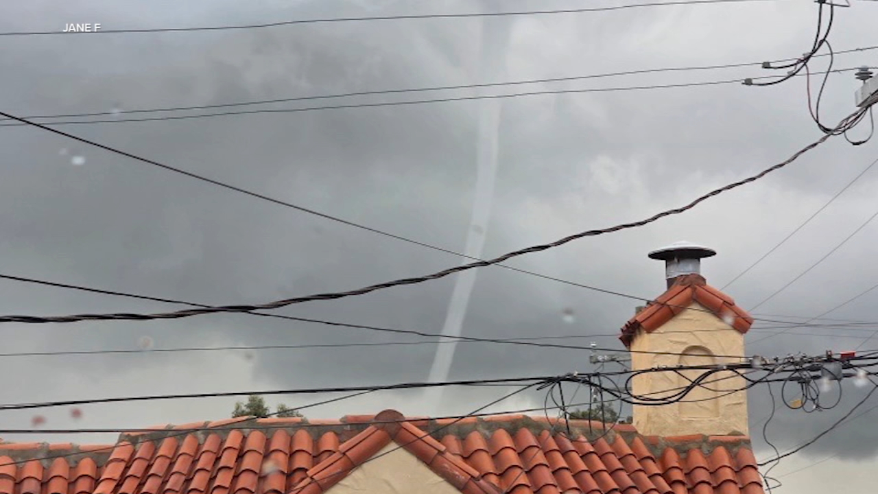

SAN FRANCISCO (KGO) -- Powerful waves and a rare weather phenomenon captured attention across the Bay Area this week as a powerful storm system brought towering surf, heavy rain and at least two waterspouts over San Francisco Bay.
Along the San Francisco coastline Monday night, crowds gathered to watch massive waves crash ashore for a fourth consecutive day. Some locations saw breaking waves as tall as a three-story building.
Live storm updates: Waterspouts spotted over San Francisco Bay amid severe weather
"I've been here 46 years and I have never seen em this big," said San Francisco resident Tommy Henry.
"Humongous waves and we actually haven't been in San Francisco for 10 years. I actually grew up here," said Ross King, who was visiting from Vacaville.
The dramatic surf followed a weekend of heavy rain and waves reaching 50 feet at Mavericks near Half Moon Bay.
Meanwhile, Bay Area residents witnessed an unusually rare sight Monday afternoon when two waterspouts formed over San Francisco Bay near San Francisco International Airport and Candlestick Point.
"I mean, initially we both were like, is that a tornado? Because it did kind of look like just this tornado," said Erin Wikle, who captured video of the event.
Residents in San Francisco and Daly City said they had never seen anything like it.
MORE: Storm expected to dump up to 4 feet of snow in Sierra, making travel near impossible
"I just looked out the window and saw something in the sky. That's very unusual. So I was, I kind of removed the curtains a little bit, and I was like, is that like a tornado? Like, what is that? That's not supposed to be there," said Jane Fong.
ABC7 Eyewitness News reviewed NOAA's storm events database, which stretches back 28 years, and found no recorded waterspouts in San Francisco Bay. While a handful of waterspouts have been documented elsewhere in the Bay Area, those incidents occurred over the ocean, not inside the bay itself.
"The closest one was really close to the shore and people were out of their cars very, taking pictures. And it was amazing, just really amazing," said Linda Frasch.
Top Stories
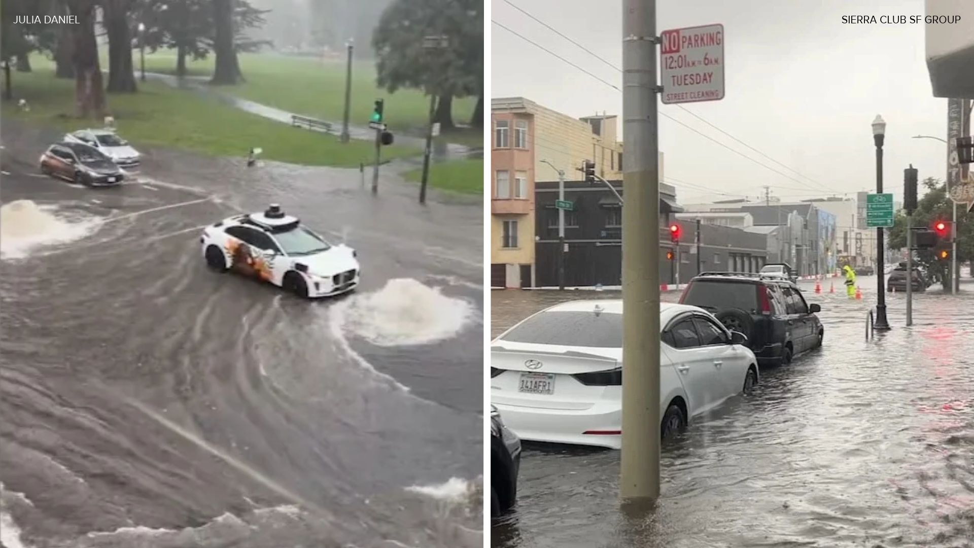
According to NOAA, waterspouts can move quickly and pose a danger to people in their path. Witnesses said both waterspouts dissipated after a few minutes.
The unusual weather has also sparked questions about whether El Niño is beginning to influence California's conditions.
"It's impossible, at least for me, to make this attribution of today's weather, but I think that El Niño is gonna, it's leaving a bunch of calling cards," said climate researcher Daniel Cayan of UC San Diego.
"It looks somewhat convincing that it's having an influence," Cayan added.
Cayan said El Niño conditions are expected to continue through February or March. Strong El Niño years in 1982-83 and 1997-98 brought significant impacts to California, though conditions were less pronounced during 2015-16.
"Have you ever seen anything like this before?" ABC7's Dryden Quigley asked Frasch.
"No. Never. Never. Not even, you know, the news, seen tornadoes, but never straight into the water like that. It was. It was amazing," she replied.
With king tides expected later this month, forecasters and researchers say the Bay Area could continue to see eye-catching and potentially hazardous weather in the weeks ahead.