TIMELINE: Level 2 storm moves in bringing gusty winds, chance of thunderstorms to Bay Area


SAN FRANCISCO (KGO) -- It's going to be a soggy and windy start to the new year across the Bay Area. We will see two Level 2 storms move through the area over the coming days.
MORE: Get the latest AccuWeather forecast here
LIVE: Track rain in San Francisco Bay Area with Live Doppler 7
Here's a timeline of the wet weather.
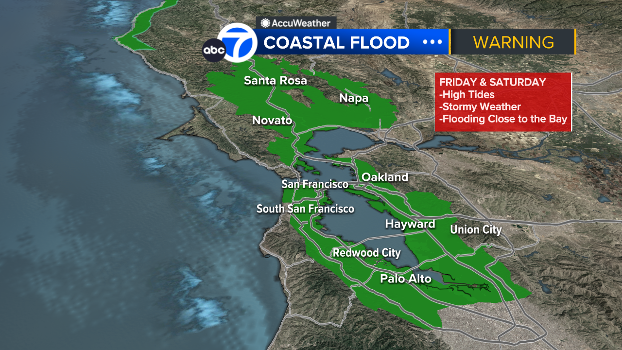
Friday
ABC7 News Meteorologist Drew Tuma says Friday morning will start off quiet but that will change around 2 p.m. He says a Level 2 storm on the Exclusive ABC7 News Storm Impact scale will start moving into the Bay Area.
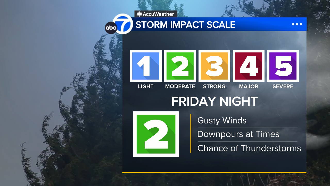
We can expect downpours and the change of thunderstorms after 5 p.m.
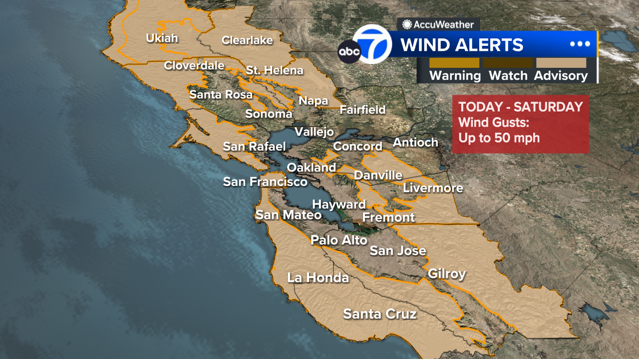
Drew says a Wind Advisory will go into effect Friday night and winds will be strongest between 7 p.m. Friday to 2 a.m. Saturday where gusts could reach up to 50 mph.
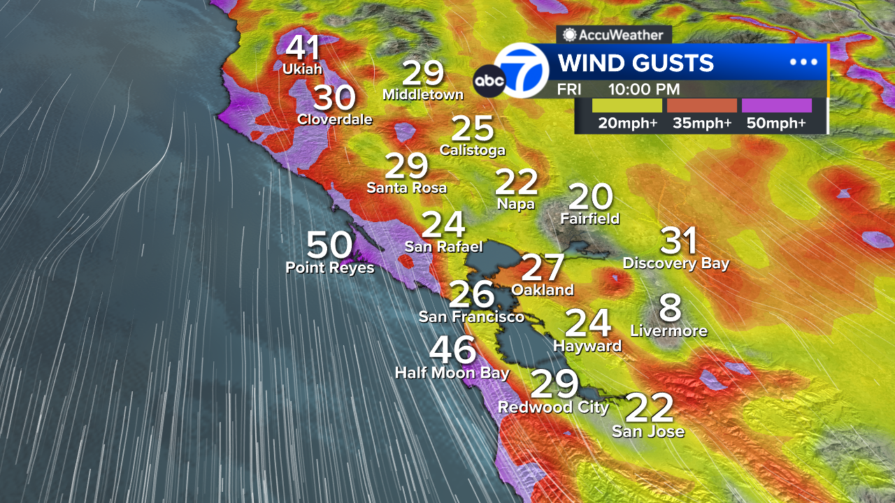
He says the threat of power outages and downed trees will exist Friday night with the highest threat along the Coast.
High tides in San Francisco are forecast to reach up to 1.8 feet above normal Friday and Saturday mornings, enough to flood coastal roads, parks and parking lots, though only isolated closures are expected.
Weekend
Storms begin to taper before sunrise on Saturday but showers will remain through the weekend.
A coastal flood advisory remains in effect for the shorelines of San Francisco Bay, San Pablo Bay, Monterey Bay and the Pacific Coast. Thursday morning high tides at the San Francisco tidal gauge are expected to rise 2 feet above normal, with about 1 foot attributed to storm surge.
Bay City News contributed to this report.

If you're on the ABC7 News app, click here to watch live