AccuWeather Forecast: Cooler day around Bay Area; increased risk of sneaker waves along coast

Takeaway of the Day
BEACH HAZARD STATEMENT on the Pacific coast, 7 a.m. Saturday - 2 p.m. Monday.
An increased risk of sneaker waves and rip currents. Breaking waves up to 16 feet are expected.
COASTAL FLOOD ADVISORY until 3 p.m. Tuesday for San Francisco and Monterey up to 1.4 feet above ground level is possible.
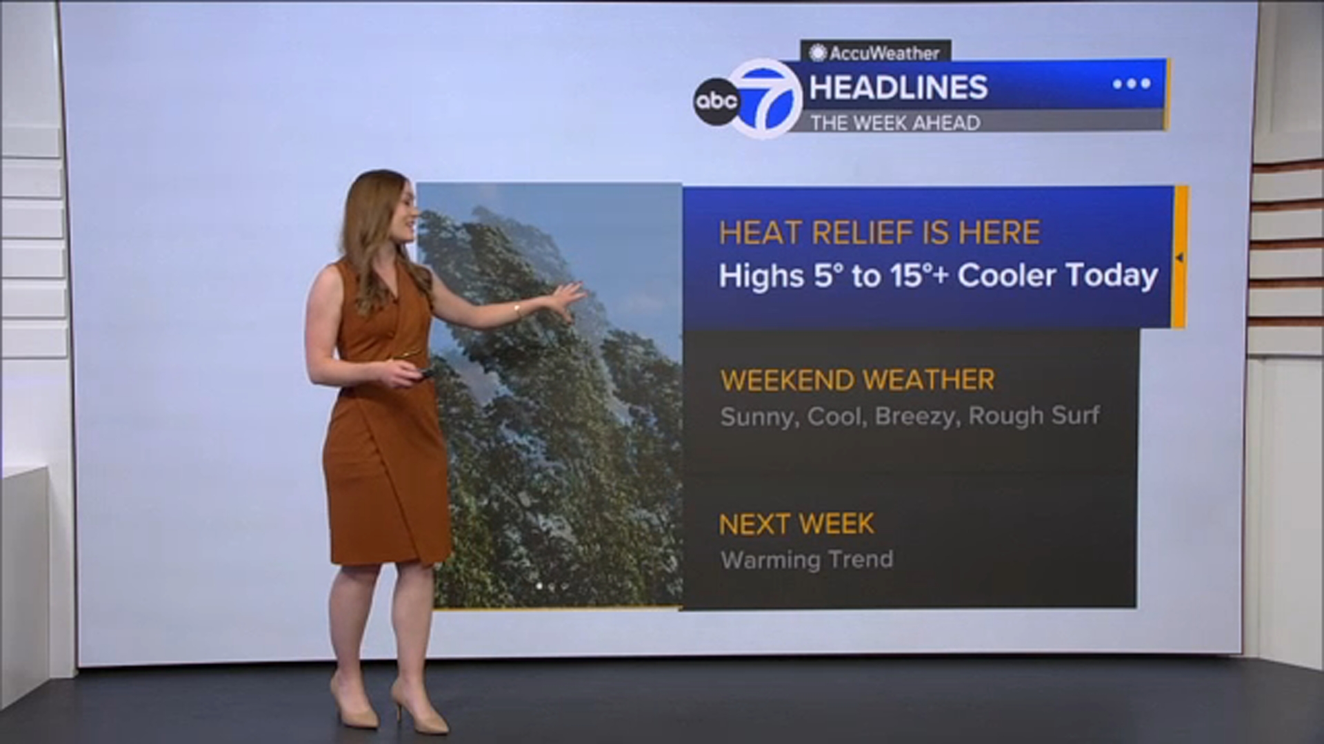
Expect patchy Clouds, fog, mist and drizzle this morning as a cold front works through the Bay Area.
Clouds will clear to the coast and winds will be gusty with continued cooling as highs will be 15 degrees cooler in spots. Winds could gust between 35-45 mph out of the north west. Highs will range from the upper 50s at the coast to the 60s bayside and near 70 inland.
A Look Ahead
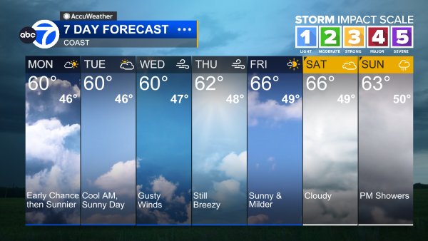
Slightly less gusty Sunday, but still cool with highs in the 60s and low 70s.
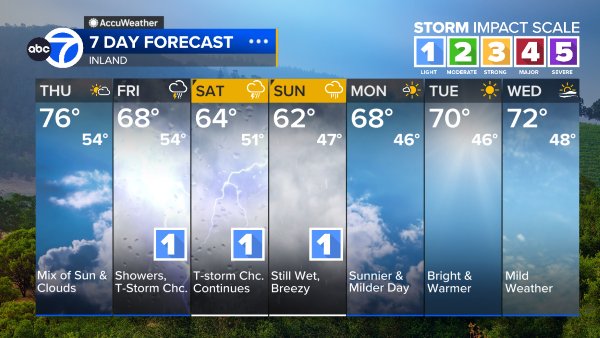
A warming trend will arrive by the latter half of the week.
Coast
Bay Shoreline
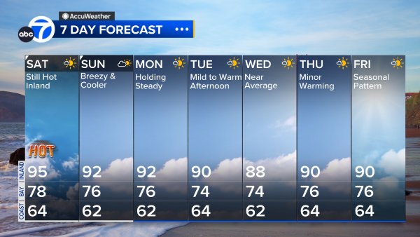
Inland
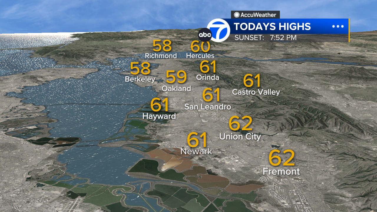
East Bay High Temps
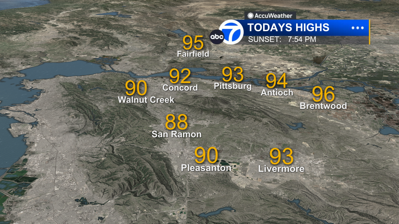
Inland East Bay High Temps
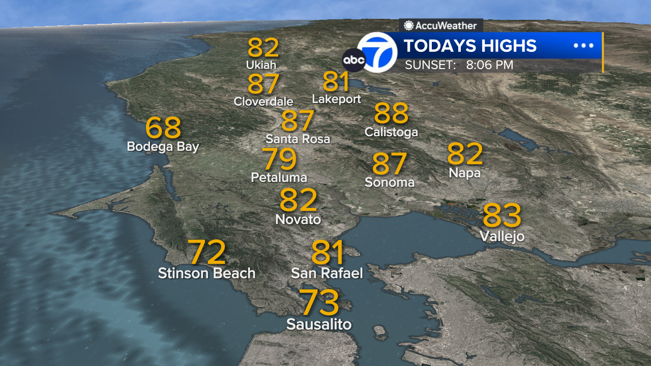
North Bay High Temps
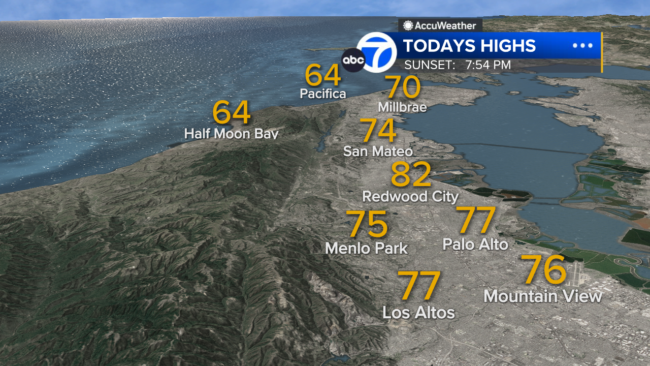
Peninsula High Temps
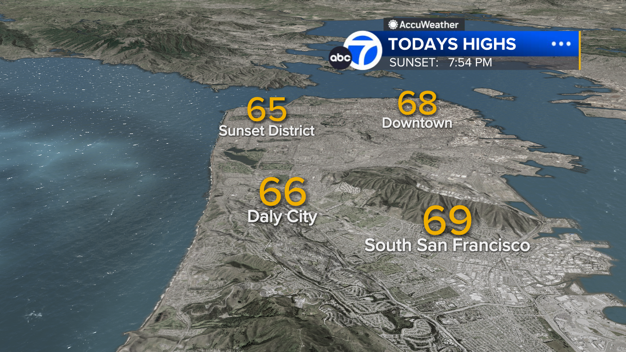
San Francisco High Temps
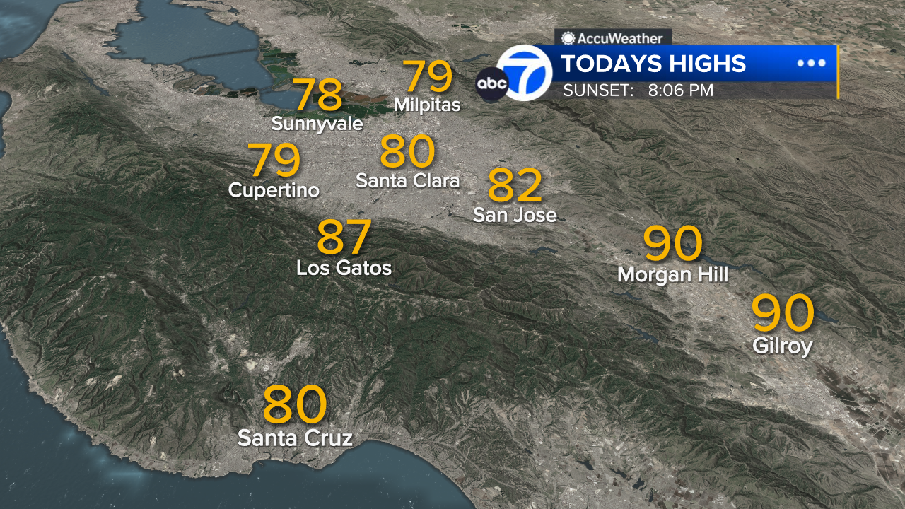
South Bay High Temps
- Download: ABC7 Accuweather app for iPhone and Android
- CA Weather Tracker: Reservoir levels, precipitation trends, snowpack totals
- Weather Radar: LiveDoppler7 radar images
- Weather Alerts: Current Watches and Warnings
- Share: Tag weather photos #ABC7Now
SHARE YOUR PHOTOS: We love seeing photos and videos from where you live! Share yours by posting with #abc7now. You must have taken the image/video or otherwise own all rights to it and agree that KGO-TV and its licensees can use, edit and distribute it without restriction in all media. Full terms: abc7news.com/share