AccuWeather Forecast: Sunny, breezy, cool tomorrow

Takeaway of the Day
We have enjoyed a sunny, breezy, and cooler than average fall day across the Bay Area. Afternoon highs were in the upper 50s at the coast, mid-60s near the bay, and lower-to-mid-70s inland. It has also been quite gusty near the coast and bay. At 4:30 p.m., gusts were between 24 and 28 miles per hour at SFO, Hayward, San Mateo and San Jose. Going into the evening and late-night hours, we can expect clear skies, diminishing winds, and temperatures dropping into the mid-50s.
BEACH HAZARD STATEMENT on the Pacific coast, 7 a.m. Saturday - 2 p.m. Monday.
COASTAL FLOOD ADVISORY until 3 p.m. Tuesday for San Francisco and Monterey up to 1.4 feet above ground level is possible.
A Look Ahead
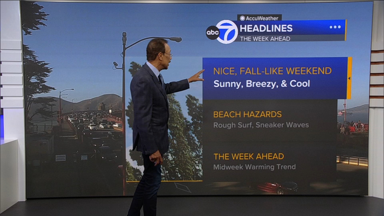
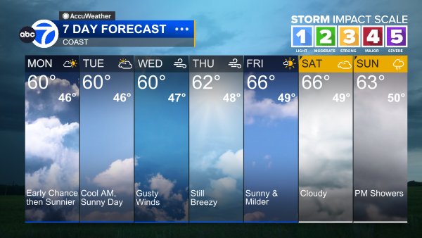
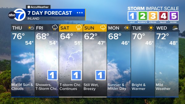
The next two days will be mainly sunny, breezy and cooler than average, but a strong warming trend will begin on Wednesday, with high temperatures reaching mid-summerlike levels by the end of the week.
Please bear in mind that a BEACH HAZARD STATEMENT is in effect until late Monday night. Wave heights are elevated, the surf is rough, and there is an increased risk of dangerous sneaker waves and rip currents. Apart from that, enjoy the pleasant weather ahead.
Coast
Bay Shoreline
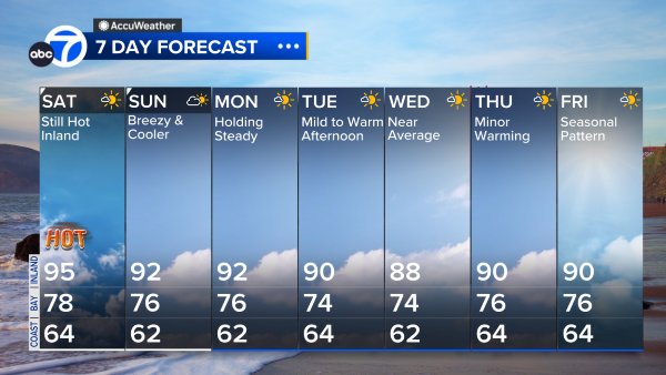
Inland
East Bay High Temps
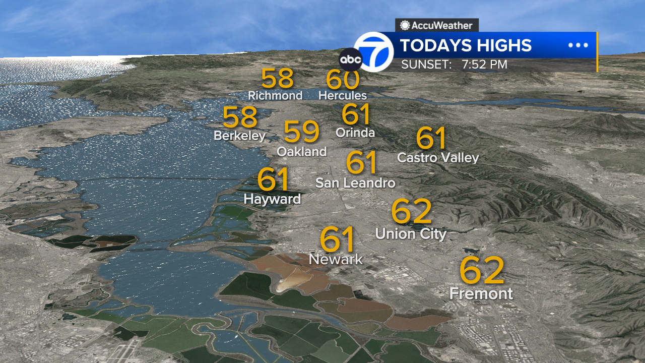
Inland East Bay High Temps
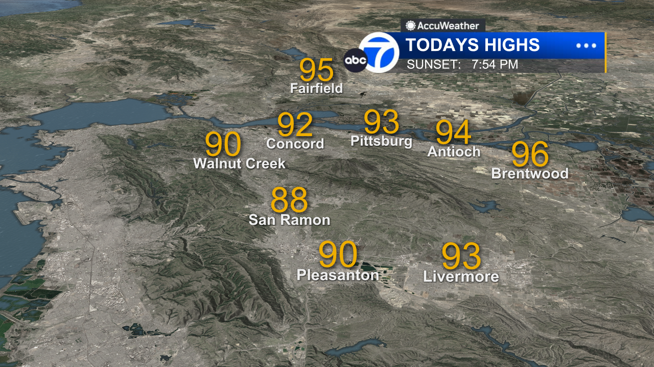
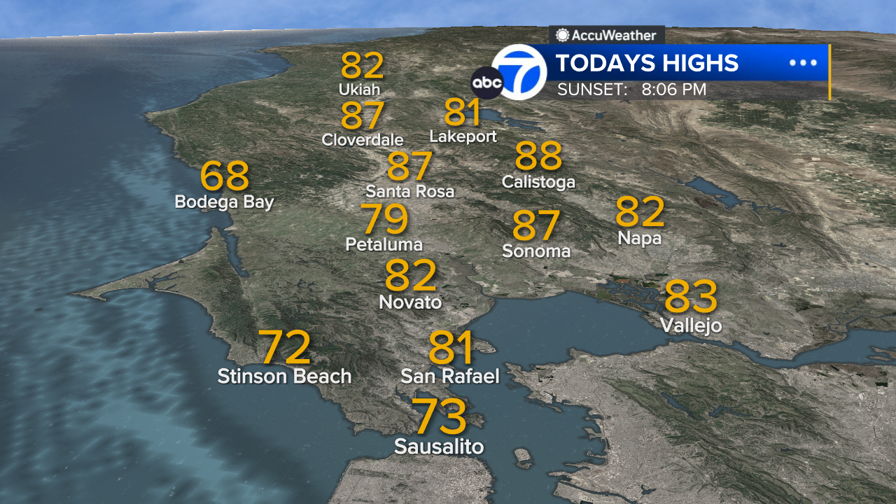
North Bay High Temps



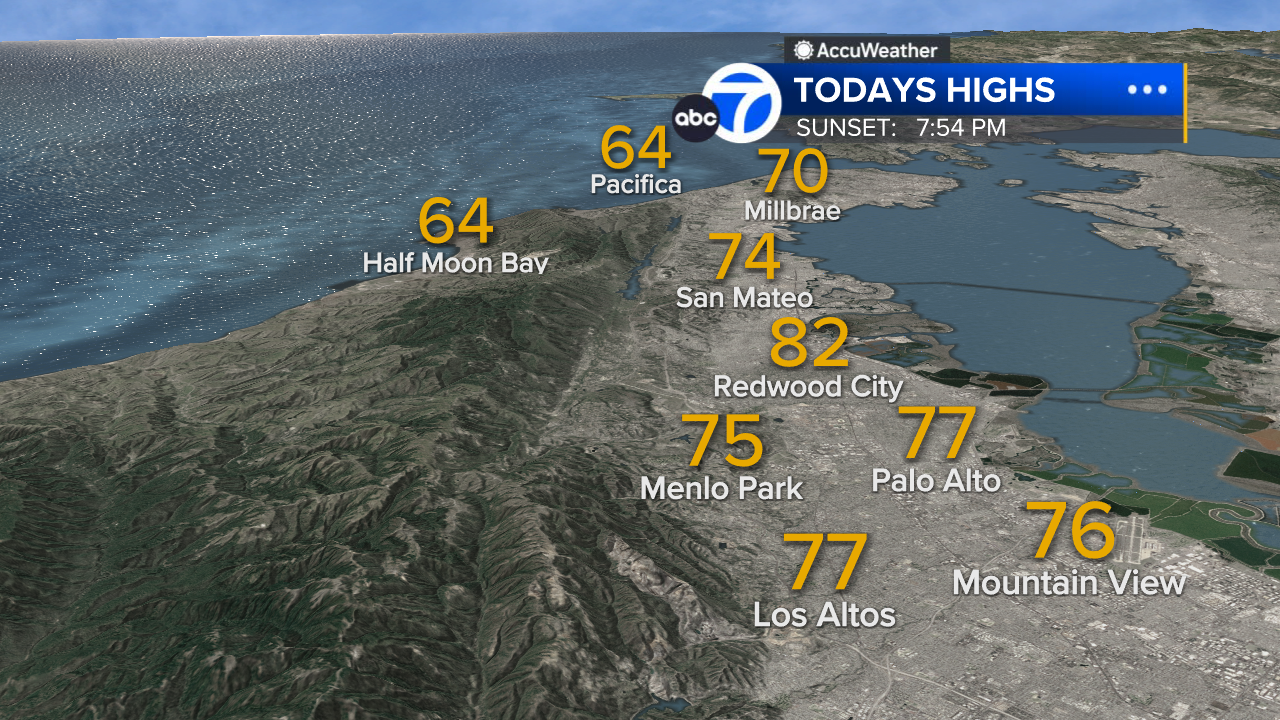
Peninsula High Temps
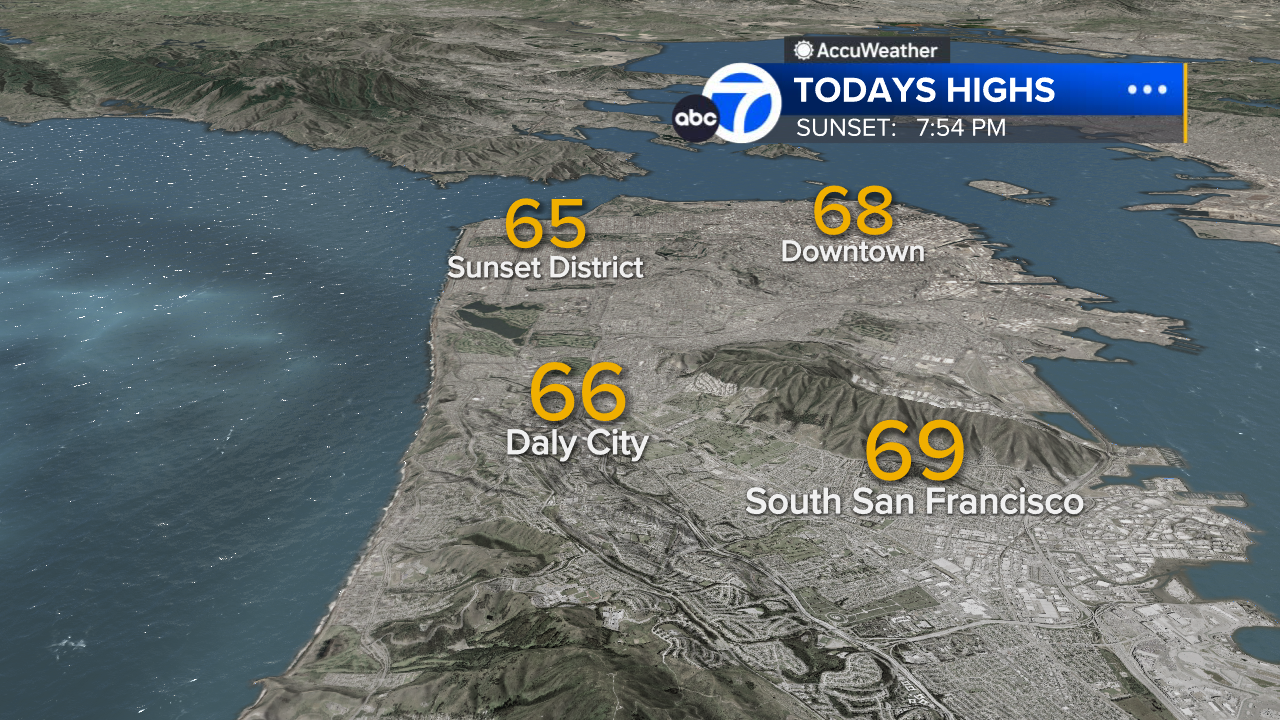
San Francisco High Temps
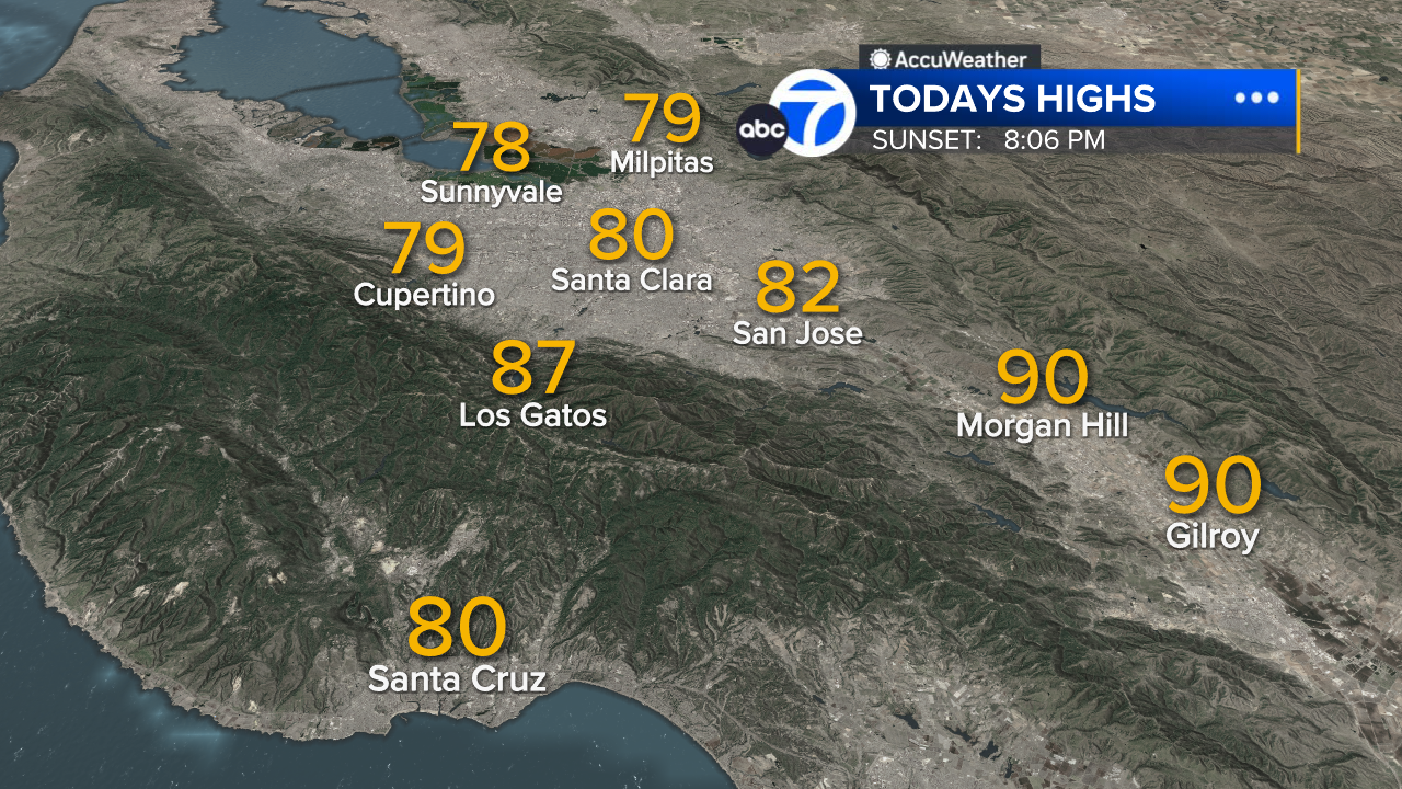
South Bay High Temps
- Download: ABC7 Accuweather app for iPhone and Android
- CA Weather Tracker: Reservoir levels, precipitation trends, snowpack totals
- Weather Radar: LiveDoppler7 radar images
- Weather Alerts: Current Watches and Warnings
- Share: Tag weather photos #ABC7Now
SHARE YOUR PHOTOS: We love seeing photos and videos from where you live! Share yours by posting with #abc7now. You must have taken the image/video or otherwise own all rights to it and agree that KGO-TV and its licensees can use, edit and distribute it without restriction in all media. Full terms: abc7news.com/share